Rides, ramblings and rants on a motorcycle.

- We are scientists, too!

10.16.2011,6:15 PM
Chain of Craters Backcoutry Byway
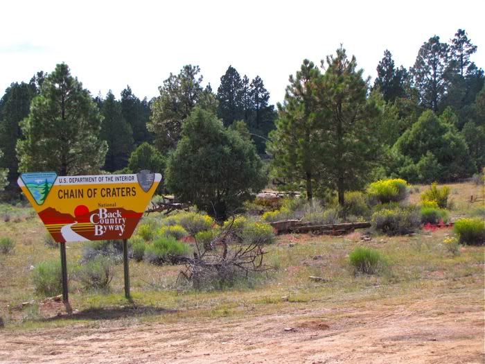
After stopping at the visitor's center for the El Malpais area to obtain road maps, we turned south on a dirt road. The road was well maintained. In fact, it was being graded even as we drove on it. We passed the grader and waved to the driver.
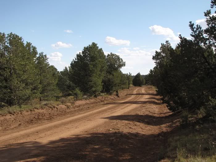
Ponderosa pines, pinyon pines, junipers, some oaks, volcanic rock, pumice. It was all wonderful and grand. And it went on for thirty miles.
Many miles later we passed the headquarters for a ranch. Which surprised me because I thought the road was on public land (BLM and Park Service). This place may be one section that was not obtained by the government. Otherwise, the road snakes through national forest, wilderness, monument, BLM designations.
Passing by the big log ranch house, and over a cattle guard (one of many), the road changes. It narrows, has more rocks and less even. In some places ruts are deep, but not impassible. Only once did we have to stop and inspect where the best lines for the truck would be (one line for a bike would be easier). And then the trees gave way to high desert shrub and grassland.
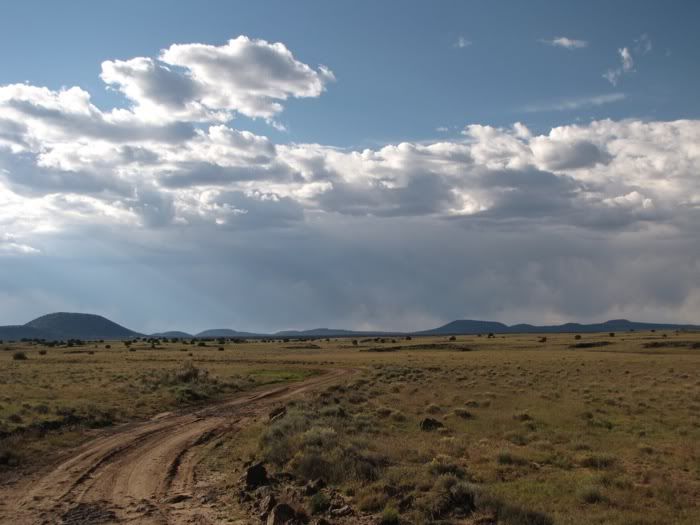
The trees and shrubs become less numerous, smaller and the horizon gets bigger. Soon we are going up on sandy arid grassland steppe country, a favorite for pronghorns. It's beautiful up there with the mountain ranges along the distance no matter which way one turns. I got out and opened up my arms asking it to embrace me. And thinking, 'I could live here. And never go down.'
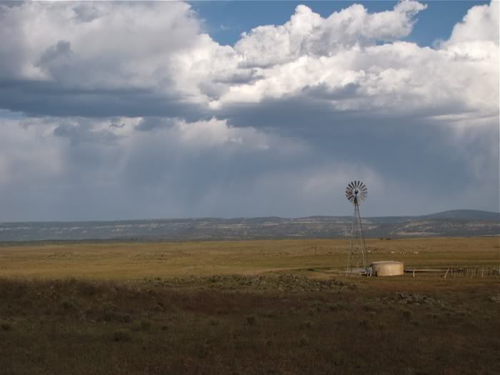
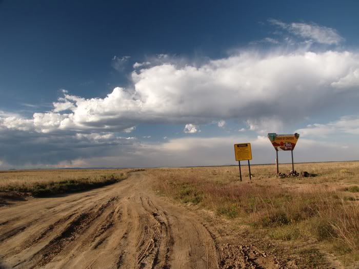 |
| View of the south end of the Byway. |
Hours after we started on the dirt road, we began to descend south off the big mesa. As we got closer to the highway, we saw a small truck with a pop-up camper pulled off and set up. Thumbs up and a wave. Far enough off the road, they can't be seen. And I bet the nights are black as black and the stars as big and bright as saucers.
Dusk was soon approaching. We drove northeast on Hwy 117, which is a well maintained asphalt road, but with little traffic. I knew that towards the north was a place called 'the Narrows'. But did not know what it was. We found out as we approached.
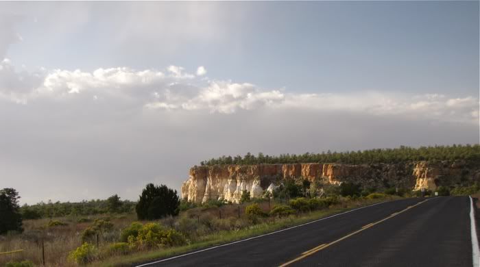 The road hugs the base of towering sandstone cliffs that mark the west edge of Cebolleta Mesa. This was once Acoma land. The lava flowed up to the base of the mesa, which made navigation treacherous. However, the Zuni and Acoma people literally chipped a trail between the two territories for trading. That trail remains today. And over time, the Acoma people have bought back some of their native land (now, how does that figure?).
 A trail ascends from a parking lot on the highway and up to the rim of the mesa for a few miles. I bet the views from there are fantastic, and it is on my list to hike when I return there.
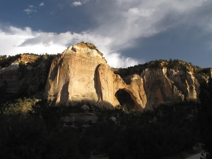
The monumental attraction is one of the largest arches in the state, even the country: La Ventana. This massive arch is breathtaking, and we were in the right spot at the right time as it was lit by the setting sun.
It was too late to stop at other points of interest along the eastern edge of El Malpais, but we knew that we would be back. Next time, I want to be on the DR and camped closer.I want to explore more on my feet.
Labels: New Mexico